-->

Monday, August 29, 2011

An Eerie Silence

Hurricane Irene has hurried off to points north leaving an array of inconveniences with which to deal. But life goes on, so this morning N631S and I were airborne and headed toward Connecticut as we are nearly every Monday. Today's trip was a quick one, as Irene's parting gifts included a tailwind at 7,000 feet of about 15 knots. This let me reduce the prop RPM to 2150, lean the fuel flow to 9.7 gallons per hour, and still make about 145 knots over the ground.

The air traffic control frequencies seemed quieter than normal, but the silence got downright spooky in New York Approach airspace. Transiting some of the busiest airspace in the world, it seemed like N631S and I were alone. On a normal day, the flight path follows airway Victor 1 from New Jersey directly over John F. Kennedy International Airport, then off to the northeast along Victor 229 to Bridgeport. Today was not normal.

Just clearing Sandy Hook, the controller asked, "Skylane 31 Sierra, would you like to go direct Bridgeport at this time, or wait until after JFK?" There just wasn't any traffic to interfere with! I responded with, "31 Sierra will take direct Bridgeport," accepting an extra mile or two of flight over water. This moved my track off to the east a few miles, allowing me to snap this picture of a nearly empty JFK. Click on it to enlarge and you'll see very few aircraft.

Flooding from Irene's torrential rains had caused the closure of Sikorsky Memorial Airport (KBDR) but one runway had re-opened at 0830 local time. Having been cleared for the visual approach to Runway 24, I contacted the Tower and the controller advised me to exercise caution due to ponding near the runway and extensive bird activity. Apparently, our feathered friends are enthusiastic about the new-born pond!

As I was about to turn base, toward the runway, the controller said, "31 Sierra, if you can give me a right 360 there, I'll get a truck to go over there and scare away the birds." I said "Wilco," and set up a standard two-minute turn while "Rescue 4" drove past the pond making noise. Finishing 270 degrees of the turn put me onto the base leg of the approach. I saw the pond, and the birds now returning to it. So I "landed long", passing over the birds and touching down well past them. It's to be hoped that the waters will soon subside, and the birds will return to their more usual environs.

Saturday, August 27, 2011

Ahead of Irene

Yesterday afternoon when I arrived at KBDR, N631S was one of the few aircraft on the ramp. With Hurricane Irene on the way, most others were either in hangars or flown away to safer locales. Earlier in the day my friend Jared Gowlis from Three Wing Flying Services had called me just to be certain that I planned to fly out. The precautions are well advised, as conditions anticipated for Sunday at KBDR are downright unpleasant. Here's the 18Z TAF issued on Saturday, 26 August:

KBDR 271939Z 2720/2818 10012KT 5SM -SHRA BR BKN004 OVC008 
     FM272300 10015KT 3SM RA BR OVC006 
     FM280200 09030G38KT 1SM +RA BR OVC006 
     FM280600 10040G49KT 1SM +RA BR OVC004 
     FM281100 10050G60KT 1SM +RA BR OVC004 
     FM281500 09060G72KT 1SM +RA BR OVC004
Yes, that last line says sustained winds of 60 knots (69 mph) with gusts to 72 knots (83 mph) from 11:00 AM until at least 2:00 PM tomorrow. Not fit for man nor beast nor unprotected airplane!

So N631S and I got underway for the trip south to KVKX, Potomac Airfield, just across the river from home in Alexandria. The clearance was what I've come to expect: vectors to SAX V239 SBJ V30 ETX V39 LRP V93 BAL Direct.*

Aside from dealing with moderately strong headwinds, the trip proceeded uneventfully for the most part. About an hour after departure I had a look at the NEXRAD display on the Garmin GPSmap 396, zoomed out to a wide view, to see where the leading edge of Irene's precipitation shield was. It was well to the south – nothing to be concerned about on that score. The only weather in Virginia was a few isolated thunderstorms unrelated to the approaching cyclone.

Later, still over Pennsylvania with an hour to go, I took a look at the situation near KVKX, my destination. Ah, there was a bit of a surprise! A couple of those summer cells had set up shop in the immediate vicinity of where N631S and I wanted to go. And with the storm on the way, this would be a bad night to have to divert. I watched those cells for a while – they were stubbornly disinclined to move away. The only good news was that there appeared to be no weather immediately over KVKX.

Just south of Baltimore, with Andrews AFB abeam, the rain was clearly visible. There still seemed to be no weather over KVKX and the approach to Runway 6 looked clear. The Potomac Approach controller asked if I wanted to try a visual approach or would I like the RNAV Rwy 6 instrument approach. I considered the visual too chancy, given the cells of weather in the area so I requested the RNAV approach and loaded it into the GNS-530W.

Approach passed along a couple of weather avoidance vectors as they routed me around the intervening precipitation and toward WOBUB, the Initial Approach FIX (IAF) for the RNAV approach. I was asked whether I would like Vectors-to-Final for the straight-in approach or the full approach with the procedure turn. Under the circumstances, it was a good idea to get N631S on the ground with all deliberate speed, so I requested the straight in.

A couple more vectors routed me toward CRROL, the Final Approach Fix (FAF) and onto the final approach course. After passing through just a spray or two of drizzle, Runway 6 at KVKX popped into view for an uneventful landing. N631S was soon snug in the hangar and I headed home to wait for Irene.


* Or, to translate, radar vectors from Bridgeport west to the Sparta, NJ VOR then south along airway Victor 239 to the Solberg, NJ VOR thence westward along airway Victor 30 to the East Texas VOR (near Allentown, PA) thence south along airway Victor 39 to the Lancaster, PA VOR thence southeast along airway Victor 93 to the Baltimore, MD VOR, thence direct to KVKX.

Tuesday, August 23, 2011

The Mark I Eyeball (cont'd)

The previous post reviewed a flight N631S and I made about a week ago, from Potomac Airfield (KVKX) to Bridgeport (KBDR), that involved coping with some convective weather. The coping mechanisms included the XM Weather NEXRAD display, advice from ATC based on their radar displays, and the Mark I Eyeball. To continue with the theme, herewith a review of last Friday's return flight with more weather and more coping.

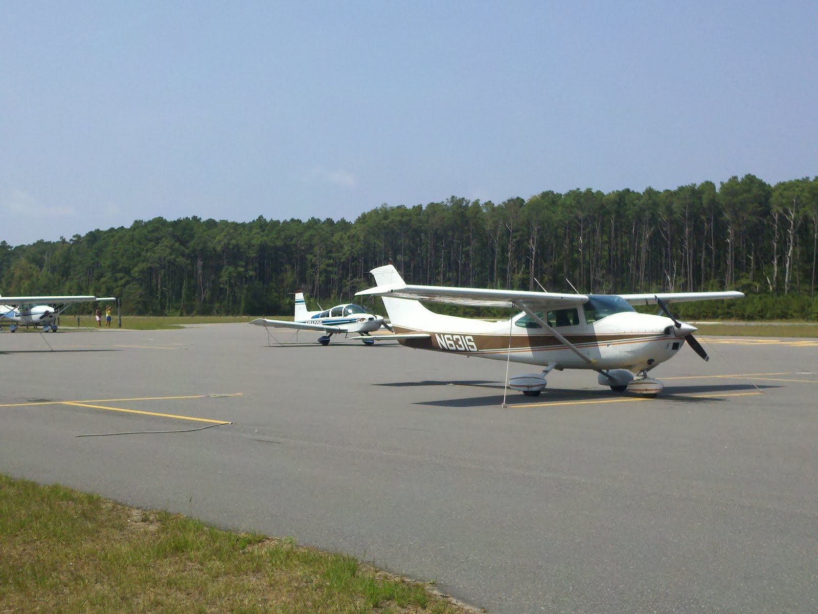
By the time I arrived at KBDR, a little after 20Z, it was obvious that my anticipated clearance over eastern Pennsylvania (via Sparta, Allentown, Lancaster, etc.) was a non-starter. I told Clearance Delivery that I was "unable" that routing due to extensive convective activity and asked for a route over Deer Park (DPK), thence JFK and Victor 16 over New Jersey down to the DC area. This time, New York Approach came back fairly quickly with a workable clearance: Vectors to DPK V16 ENO V268 SWANN BAL thence direct to KVKX. That was about as good as I was going to get.

I was already aware of a sizable patch of stormy weather churning around over Delaware and eastern Maryland and not moving too quickly. My working theory was that I could get started and head down there, get at least as far as southern New Jersey, and then work with ATC to work through that OR work around it OR land somewhere and wait it out. But the route across JFK and down through central NJ looked good – so we got underway just about 2030Z.

The screen capture at left, taken about 20 minutes after departure, is interesting for two reasons. First, all of that colorful stuff off to the northwest gives a good idea of why the original clearance's route was not going to work. I for one wouldn't care to fly through all that! Second, there's a little surprise waiting for me up ahead, southwest of DIXIE. Where did that come from? About forty minutes before, a last look at the radar display at the FBO had shown no weather at all in that part of New Jersey. I activated the "Animate Weather" option on the Garmin GPSmap 396 and got an answer. The weather in question had popped into existence about 25 minutes earlier and had grown explosively! Well, now I needed to deal with it.

Nearing DIXIE, New York Approach handed me off to McGuire Approach. As I checked in with McGuire I asked if a deviation left, perhaps "direct Atlantic City", was in order for weather avoidance. The controller advised that I should expect a turn to a 180 heading in a couple of miles. That surprised me, but his display's information was more current than mine. I'd happily accept the more aggressive turn.

The turn to the south came quickly, along with a descent from 6,000 feet to 4,000. This proved to be quite important because it allowed me to "stay visual" on the weather for the rest of the flight. Then, after about five miles the controller asked, "Skylane 31 Sierra, can you accept a 230 heading at this time?" Well, I figured, first, he wouldn't have asked if it didn't look acceptable to him. And the NEXRAD picture indicated that the proposed heading would keep me out of the more undesirable colors.

And, finally, looking off to the right I didn't see anything intimidating. With all inputs in favor, I turned N631S to the 230 heading. That done, my friend at McGuire Approach handed me off to Atlantic City Approach. I checked on and the ACY controller gave me an altimeter setting and added, "Deviations for weather are approved, just let me know what you're doing. And advise when you can head back toward Victor 16." I said wilco, but that it would be a while.

I kept N631S on the 230 heading, essentially paralleling Victor 16, until the NEXRAD display and the Mark I Eyeball agreed that the more enthusiastic weather was passing behind us and that a turn to the west was workable. In fact, the display showed a nice clear path back over to the Cedar Lake VOR (VCN), which is on the Victor 16 airway. I told the controller I thought direct VCN would work and got an "Approved!" from him.

That turn to VCN was the start of a quiet 15 minutes, which I used to think about my options for the next part of the flight. This was where the weather began to look really interesting. There was no obvious path on the NEXRAD display toward and beyond Dover AFB. The clear lane I was in continued west toward Wilmington but there wasn't a clear "out" at the far end. There was a path around to the east but it would be a long detour. Well, soon Atlantic City would hand me off to Dover Approach and I would discuss the situation with them.

As N631S and I crossed the New Jersey coast and headed out over Delaware Bay I was switched to Dover Approach. Checking on, I asked the controller how the weather was looking to him. He replied, "We have areas of moderate to heavy precipitation. Turn to a 240 heading."

Now that didn't look too slick on the NEXRAD display. But the controller liked it, and to the Mark I Eyeball it didn't look too bad at all (left). OK, I'm in. If it got nasty I could turn 180º and trek off to the east. But with clouds to the left and clouds to the right, I was flying toward the light, in light rain and smooth air.

The Dover controller bent my course a little further to the left and asked what my flight conditions were. I told him, and he said, "It looks like you'll go through some moderate rain...it's about the best you're going to do." There was one more patch of precip to get past, and conditions were really not too bad.

The photo at left was taken just seconds after the preceding screen shot. It shows about the worst flight conditions I saw during the entire flight. But the path toward better conditions is clearly visible and it was consistent with the controller's guidance. And in a few more minutes N631S and I flew into the clear.

From then on the hard part was over. I should note that the area of rain I worked through with the help of the Dover Approach controller (and the Mark I Eyeball) was free of any indication of lightning. I saw a couple of flashes off to the left while crossing Delaware bay, but none where I was actually headed – the presence of lightning would have required a different plan. As it was, once past those rain cells the rest of the flight across eastern Maryland and into the DC area was clear of weather. My array of tools for coping with the adverse weather appeared to have served me well.

Saturday, August 20, 2011

The Mark I Eyeball

In writing posts for this blog about my weather flying experiences, I've commented favorably on more than one occasion about the utility of weather displays in the airplane. NEXRAD, XM Weather, that sort of thing. I have been, and I remain, convinced that these displays are of remarkable value in dealing with the challenges we encounter when we choose to commit aviation at times and places where the atmosphere is grumpy.

Two flights in the last week have reminded me of how vital it is to stay aware of the limitations of NEXRAD displays and to always remember that they are only one voice in the chorus, one instrument in the band. Depending on circumstances, other inputs may be more important and more informative. All sources of information have to be integrated to arrive at the best decision. You have to meld information from the controller's ASR radar display and input from the view through the windscreen with the picture on the XM Weather display to get the best image of what is happening. Last Monday's flight from Potomac Airfield (KVKX) up to Bridgeport (KBDR) was illustrative.

It wasn't long after departure from KVKX until N631S and I started to see some weather. We were at 7,000 feet, talking to Potomac Approach. There was a fairly energetic cell to the north near Baltimore, and a lesser patch of weather to the south. No problem navigating between them. But it was interesting to correlate the view through the windscreen with the XM Weather display on the Garmin GPSmap 396.

The view at left is out to the right, observing the less energetic but closer patch of weather seen above. It's still fairly benign, although the cumulus core is building. That cell may have gotten a lot more interesting over the next twenty minutes. Bear in mind that this is happening at 7:30 AM Eastern time! Not all convective weather happens in the afternoon. But we flew between the cells with plenty of clearance and pressed on toward New Jersey, soon to be handed off to Dover Approach.

Once past that first bit of weather I zoomed out on the NEXRAD display to see what was cooking up ahead. The situation in the area of the LEEAH intersection looked interesting! Normally, N631S and I stay with Dover as we cross the Delaware Bay and get handed off to Atlantic City Approach as we cross the New Jersey shoreline. I asked the Dover controller to give Atlantic City a "heads-up" that I'd be welcoming a deviation to the left of course approaching LEEAH.

I checked in with Atlantic City and talked to the controller about what he was seeing on his radar. I wanted to turn to the northeast, toward the Coyle VOR (CYN) at a point that would minimize my exposure to the two cells up ahead. A few miles before reaching LEEAH I asked for "direct Coyle", which was approved. That flight path is shown above left. As I skirted the first cell off the right wing, N631S and I experienced some moderate precipitation and some light, to occasional moderate turbulence. Nothing scary! Looking to the left, the Mark I Eyeball reported brighter conditions – I could have deviated to the left if necessary, although that would have required some negotiation with Philly Approach. Flight conditions in the second patch of weather, east of VCN, actually were calmer with only light precipitation and minimal turbulence.

N631S and I broke out into fairly clear skies and continued north toward JFK. A look ahead indicated that only light precipitation was to be expected over Long Island and near Bridgeport. In fact, Bridgeport was still reporting VFR conditions!

The screen shot at left, taken soon after crossing over JFK, shows widespread light precipitation. You would think that N631S and I would be getting wet at that point, but that wasn't the case. The NEXRAD composite radar image can't indicate conditions at any specific altitude.

This screen shot (left) was taken just seconds after the previous one, and shows what N631S and I were actually flying through. We were at 3,000 feet at the time, with no precipitation, no turbulence and reasonable flight visibility. Again, the Mark I Eyeball tells a different – probably more reliable – story.

By the time we got near Bridgeport the ceiling had lowered to 800 feet, so it was necessary to fly the ILS approach to Runway 6. That, and the landing, were uneventful.

Looking back, the flight had relied on information from the NEXRAD display (XM Weather) for the "big picture" and weather avoidance strategy; and on the Approach Radar's excellent real-time information to guide the penetration of moderate adverse weather. And, reference to visual inputs to maintain a real-world picture of what N631S was flying through.

In the next post here, I'll share some details on Friday's flight from Bridgeport back to the DC area – where information from the Mark I Eyeball became the primary input needed for successful completion of the flight on a boisterous evening.

Thursday, August 18, 2011

21st Century Charts?

Not all that long ago, nearly every airport's FBO could sell you a reasonable assortment of charts. They would, typically, stock the (VFR) Sectional Chart for the local area and for a few nearby areas along with corresponding (IFR) Low Altitude Enroute Charts and books of Instrument Approach Procedures (IAP's or "Plates"). Then a few years ago the rules changed for chart distribution agents and a ton of those small airport FBO's got out of the chart-selling business. Since then, I've gotten my charts via mail subscription. That has worked just fine, but presents a problem when a trip is planned on fairly short notice that will venture into areas beyond the coverage of the charts that are in the airplane. Such was the case with last week's trip to North Carolina and Tennessee.

While I was wondering how I was going to lay hands on Enroute Charts and Approach Plates covering my intended routing down the Outer Banks, across the Appalachians and then back home, a solution came along courtesy of Tony Oliva. Tony is a retired USAF pilot, with thousands of hours in B-47's, C-130's, C-141's and who knows what else. These days he flies a 1977 C-182Q, a sister to N631S. Tony is also a member of the Cessna Pilot's Association, and he described in a post on CPA's forum his acquisition of a tablet computer and a subscription to an on-line service that furnishes all of the Sectionals, Enroute Charts, and Approach Plates you could ever desire. If Tony, whose wisdom on all matters related to aviation I respect immensely, thinks something is a good idea that's good enough for me. So on the Saturday before our intended departure I set out to replicate what he had done.

The result appears at left, sitting on my knee-board somewhere over West Virginia on the way home. The hardware is an Acer Iconia A500 Tablet with 16GB of internal memory, running Android Honeycomb 3.1. The tablet is Wi-Fi capable which allows the downloading of the software side of the solution – Aviation Maps ver 1.3.15 from Avilution. For just $4.95/month, Avilution makes available for download all of the Sectionals, Enroutes and IAP's for as many states as you care to specify. The initial download takes quite some time, but updates happen more quickly. And then the fun starts.

You can enter flight plan way-points and the software draws a magenta line on the screen showing the intended route of flight. You can tap additional waypoints on the screen and insert them into the flight plan. If you tap an airport you can then bring up the A/F-D (that's the "Airport/Facilities Directory") information on it...and another tap brings up any Approach Plate you may need. The Iconia's 10.1" screen provides a crisp, legible display. Finally, the internal GPS allows the system to track your progress (via a little airplane icon) as your flight proceeds.

The now-familiar "pinching" gesture on the touch-screen lets you scale the displayed chart to suit the situation and a "sliding" gesture re-centers the chart as needed. And you can switch between the Sectional view and the Enroute Chart view virtually instantaneously.

The display is, let's say, acceptable in bright sunlight...which is pretty good for an LCD. Battery life is excellent – I ran it for about 5.5 hours and still had plenty of charge in reserve.

There are a couple of things I need to work on. First, the tablet needs a home. Just sitting on my knee or on the right seat isn't a permanent answer. Second, the Iconia's internal GPS doesn't hold satellite lock very well. I'm looking at the possibility of getting a low-cost Bluetooth GPS receiver that could sit up on the glare-shield and pair with the tablet. But other than those items, I really like the system. I need to fly with this solution for a while to be sure that I understand where any pitfalls may be. But it looks like I'll be able to let my paper chart subscriptions lapse.

And yet... I just like the paper charts so much. A decade ago, Stephan Wilkinson had an article in Air & Space Magazine titled "The Art of the Chart", wherein he gave voice to the affection we pilots (of a certain age?) have for those lovely paper artifacts. As long as paper charts are printed, N631S will have on board at least the local Sectional so that twice a year I can unfold and admire a new one.


The end of my previous post left us on the ground at KJWN in Nashville. Patricia and I enjoyed three days of seeing the sights in and around that fair city but on Friday it was time to head home. With the expected tailwind, there was no need to plan a fuel stop, but a "butt break" would be in order. So I filed a fairly direct route to Charleston, WV's Yeager Airport (KCRW).

Flying over West Virginia, the most prominent features in view are the surface coal mines, both active and closed. In the cases of active mines, the surface of the earth has been torn open to expose the black coal seams that lie under the shallow strata of stone. The closed mines are undergoing remediation but still appear unnatural and devoid of life. It will be years before nature reclaims those devastated areas.

We landed at KCRW and bought sandwiches and salads from the deli case at Executive Air Terminal, the FBO – actually quite fresh and tasty. Then we took off on our last leg, climbed to 9,000 feet (to get 4,000 feet of terrain clearance over the mountains) and headed for home. After an uneventful flight we landed at KVKX about 3:30 PM.

Over the six days since leaving on Sunday morning we'd put 11.6 hours onto N631S's tach. We'd flown over five states and landed at six airports. And we'd burned about 128 gallons of 100LL aviation gasoline at an average cost of $5.33/gallon. And we had fun!

Tuesday, August 16, 2011

Some Time on the Road

Last week brought an opportunity to take advantage of N631S's true raison d'etre as a traveling machine. I've already shared a few thoughts (here) on our first stop at Kitty Hawk (KFFA); from there we flew down the Carolina Outer Banks to Ocracoke Island Airport (W95), where we landed about 3:30 PM on Sunday.

The strip on Ocracoke is quiet but well maintained, with ample free parking (left). As with KFFA, there's no fuel available but there is a nice planning facility (again the keypad code for access is "Squawk VFR"). Our hotel was quick to send someone around to collect us after we tied down the airplane, and drive us the half-mile or so to the Village. We'd planned only a brief stay for our first visit but did check off the essential items including:
We were back at the airport Tuesday morning, ready to head for our next destination, Nashville, TN. But before that, a fuel stop would be necessary. We'd left KVKX with 75 gallons of AvGas on board which is (conservatively) good for 6.2 hours. The flight down to Kitty Hawk burned 1.6 of that, and the leg to Ocracoke another 0.8 so we were left with about 3.8 hours in the tanks. I'd planned a 2.0 hour flight to Stanly County Airport in Albemarle, NC (KVUJ), chosen because it was (a) on the way, more or less, and (b) able to supply fuel at what now passes for a reasonable price – $5.23/gallon, self-service.

After landing at Stanly County and pumping 49 gallons of 100LL into N631S, we walked over to the terminal and inquired about lunch. The pleasant gentleman at the desk handed us the keys to the "crew car" (a clean and well-maintained van) and directed us to the Log Cabin BBQ Restaurant, where we had a delightful meal. We returned to the airport (stopping to put $10 worth of gas in the crew car...you do put gas in the crew car, don't you?) and got on with the trip. This would be the long leg.

Knowing that there would be some tall country between us and Nashville – and that we'd need to circumnavigate Charlotte – I'd filed from KVUJ northwest to the Barrett Mountain VOR (BZM) then southwest to Sugarloaf (SUG) thence across the mountains to Volunteer (VXV) then to Nashville (BNA) and into our destination, the John C. Tune Airport (KJWN). It's rare for me to get N631S above 8,000 feet but I'd filed for 10,000 this time to ensure some space between us and the hilltops.

On our way, we were step-climbed up to 10,000 feet – first by Charlotte Approach and then by Don Brown's old friends at Atlanta Center. Before we reached BZM we were turned "direct Sugarloaf", and soon thereafter our controller said, "Skylane 631 Sierra, cleared direct to Volunteer." To which I said, "31 Sierra, stand by."

One of the reasons I'd filed via SUG to VXV was that I was comfortable with the clearance provided by that route between our cruising altitude and the elevations of the Appalachian peaks in that area. Now the controller was going to take me off-airway in mountainous terrain and I was sure as hell going to look at the chart before I accepted the vector. But a quick look at the sectional put my mind at ease. The Atlanta Center controller had let us proceed far enough toward SUG to ensure that the turn westbound toward VXV would keep us south of the tallest peaks and maintain several thousand feet of terrain clearance. So I keyed the mike and said, "Center, Skylane 631 Sierra is turning direct Volunteer at this time."

As a life-long flatlander, I found the scenery crossing the mountains both beautiful and intimidating. The forested slopes are surely pretty, but there are very few hospitable places to put down a sick airplane. It certainly reminded me of why we need to take maintenance seriously.

Having crossed the mountains, we still had about two hours of flying left across the relatively flat terrain of east Tennessee. There was a small amount of rain along our flight path and we accepted avoidance vectors from the Memphis Center controller. I'd assumed all along that they wouldn't actually let us fly across the city via BNA to get to our destination airport, and as expected, we received vectors for an arc around the north side that set us up for an easy straight-in to Runway 20 at KJWN. I'd selected that airport for its convenient location and not-too-outrageously priced self-service AvGas ($6.13/gallon). After the 3.5 hour flight from KVUJ, we pumped 38 gallons of the precious stuff and parked N631S. A small consolation: there is no landing fee for light singles, and if you buy fuel and park the airplane yourself, they waive the parking fees.

The FBO had organized a rental auto for us (which they drove out to us at the fuel pump so we didn't need to schlep luggage). We got underway toward our hotel in Nashville and a few days of sightseeing and avoiding country music. And I shall save the trip home to KVKX for another post.

Saturday, August 13, 2011

Just...Damn!

Having just last evening returned home from a week of aviating and vacationing (beginning with the visit to First Flight described here), I got around this morning to catching up on local events. One item caught my attention with the headline "Two Die in Fauquier County Plane Crash". I clicked through to the story, saw the sub-head...and my heart dropped like a stone. "Shannon Beebe, 42, was flying single-engine aircraft when it crashed Sunday at Warrenton Air Park." I scrolled down quickly, hoping to not see Elizabeth's name, but expecting the worst...which is what I found: "WJLA is reporting that the female passenger was Alexandria attorney Elizabeth Pignatello.". Damn! Just...damn!

Pat and I had met Shannon and Elizabeth only recently, but we were immediately drawn to them. We spent most of a recent party sitting with them poolside, talking flying and airplanes and travel and family. They were relaxed and friendly and warm. We parted with plans to get in touch about organizing a "fly-out" for pilots based at KVKX. Shannon was a Lieutenant Colonel in the United States Army. He'd graduated from West Point in 1991, and had served our country in the Balkans and in several posts in Africa. Currently posted to the Pentagon, he was a a noted expert on African affairs. Elizabeth was a patent and securities attorney in private practice, and a mom with two small children.

Shannon Beebe, a Commercial Pilot, was consumed by a love of flying. He didn't have an airplane of his own but he had lots of friends with airplanes and never seemed in want of a ride. He had logged 1,000 hours of bush flying in Alaska and Africa and that, along with seaplane flying, was what he loved the most. The airplane he was flying last Sunday was a friend's Maule M-7-235 on amphibious floats. The NTSB's Preliminary Report quotes a witness, in part:

...he had observed the airplane enter the downwind leg of the traffic pattern for the runway and while turning from the base leg to the final leg of the approach the airplane banked to the left. The airplane appeared to continue to bank to approximately 75 degrees, at which point the nose pitched over to an almost vertical attitude. The airplane impacted the ground in an open field prior to the runway threshold, and exploded.

This one hurts a lot.


Elizabeth Pignatello & Shannon Beebe...Gone West 8/7/2011

Thursday, August 11, 2011

Pilgrimage

The wind, as you stand at the base of the monument atop Kill Devil Hill, blows briskly and steadily. It was the wind, of course, that they came for. They used it to launch their kites, to struggle with the 1901 glider, to learn to fly in the 1902 glider and finally, to become pilots with the 1903 Flyer. And now, we come to feel the wind, to walk the ground, to marvel at what they did here. Kitty Hawk is our sacred ground and here we come for our pilgrimage. We know that we are each descended in a fraternal lineage from Wilbur and Orville and so we feel that when we finally come here – when we walk this ground – we have come home.

Last Sunday, Patricia and I took N631S down to the North Carolina Outer Banks and landed at First Flight Airport (KFFA). The little airfield is operated by the National Park Service as a part of the Wright Brothers National Memorial. It's a day VFR-only strip, but plenty of parking space is provided, free for 24 hours.

A few years ago, AOPA funded construction of a very nice pilot planning facility (with restrooms) immediately adjacent to the parking ramp. Access to the flight planning room, with its Internet-connected computer, is gained by entering "Squawk VFR + #-sign" into the electronic lock. There are picnic tables under shade trees for enjoyment of a pleasant lunch.

Our visit reminded me of a lesson learned years ago while visiting the Gettysburg battlefield. It's this: that you can study the events associated with an historic site all that you want, but a full understanding of what happened there will elude you until you walk the ground. The thing that had eluded me, despite having read many accounts of the Brothers' work at Kitty Hawk, was the great significance of the fourth flight of that December day in 1903.

We read all about the triumph and elation surrounding Orville's first flight, the culmination of those years of research and trial and error and cut and fit and test and adjust. We study that black-and-white image, captured at the perfect moment by Surfman J.T. Daniels – perhaps the most famous photograph in aviation history. Orville, in the Flyer, totally immersed in the immensely difficult task of controlling that balky steed. Wilbur, with the thing out of his hands, watching with time seeming almost suspended as history is made. And we, more than a century on, feel the thrill.

And oh, by the way, they made three more flights that day...before an errant gust of wind damaged the Flyer beyond quick repair. Three more flights from the launch rail in the sand, into the steady breeze. Those additional flights don't attract much interest...until you walk the ground.

The photograph at left is taken from the spot where Wilbur landed at the end of the fourth flight. Those small gray structures in the distance are replicas of the sheds that the Brothers built at Kitty Hawk...their "hangar" and the cabin they lived in. The launch rail was in the sand immediately adjacent to those structures. On it's fourth and final (ever!) flight, the Flyer took off from that distant point and flew all the way to where I stood to snap that image. The distance is more than four times that achieved on any of the first three flights. Farther than the first three flights added together. Far enough to be, arguably, the truly dominant success of that cold, windy Carolina morning.

852 feet. A sixth of a mile. 59 seconds. Nearly a minute of barely-controlled pitch-unstable 30 mph flight! This, then, was the confirmation. There could be no argument after the fourth flight, that this was any insignificant hop. The first flight made history, but the fourth showed that powered flight by heavier-than-air aircraft would thenceforth be part of the canon of human accomplishment. I walked back to the launch point, along the path that Orville and the other spectators hurried along 107 years and some months ago to congratulate Wilbur. I would never think about the First Flights in the same way again. In the end, that's what a pilgrimage is for, isn't it?